Photo numbers are taken directly from the Kodak Photo
CD disk. I may also have re-ordered them to make a more coherent presentation
of the photographs possible. Thus the erratic numbering.
A Day In Historic Virginia City, Nevada
Virginia City lies on the northern slope of Mt. Davidson in Storey County Nevada (to the southeast of Reno). It was founded as a city around 1860, prior to the U.S. Civil War, when the prospectors who were flooding west in the California Gold Rush discovered gold ore in the hills around what is now Virginia City. Pat McLaughlin and Peter O'Reilly are credited with discovered gold in Six-Mile Canyon in 1857, although it was Henry T. P. Comstock who first laid claim to the land on which Virginia City is built. Ironically, one of the most difficult problems the early miners had was removing the gold from the sticky blue-gray dirt and mud which was so common in Six-Mile Canyon. In 1859, an assayer determined that the mud which the miners were struggling with was actually silver enriched earth. Over the next three or four decades, literally hundreds of millions of dollars in silver ore was mined from the Comstock Lode including a single vein which returned more than $100,000,000 to the Mackay family.
At its peak, over 30,000 people lived in Virginia City. Mark Twain, who fled Missouri in part to avoid conscription into the Confederate Army, was the editor of the local newspaper. He is perhaps the most famous resident of the time. Its size made Virginia City the largest city west of the Mississippi River in the North America at the time, a title it retained until the 1900 Census at which point the city relinquished the honor to a California coastal town the miners of Virginia City had helped to found some decades earlier... San Francisco. In 1875, a devastating fire destoryed over 2,000 buildings in the town, but much of the town was rebuilt using the vast wealth of its residents. By the 1890s, most of the silver to come from the Comstock Lode had been mined and the town's population began to decline as a result.
Today, Virginia City is an historic tourist attraction and is home to a few thousand rugged Nevadans.
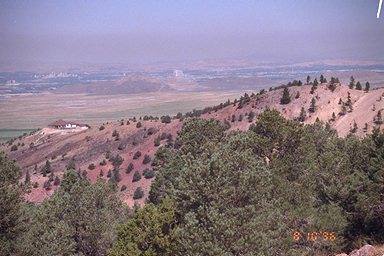
[64] A view of Reno from the Geiger Grade Highway
(Nevada State Route 341). The view of the Washoe Valley, which houses Reno,
Nevada was obscured at the time due to smog from a wild fire burning about
100 miles to the northwest of Reno near Susanville, CA. Wild fires in late
summer are frequent in northern California and Nevada, but 1996 was a particularly
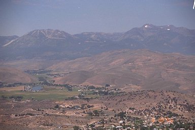
destructive year. [65] A view of Mt. Rose (right) and Slide Mountain (left)
from the Geiger Grade Highway. [66] Another view of Reno, and part of the
highway can be seen below.
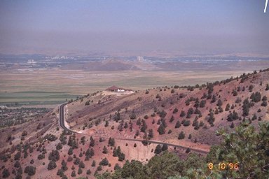
[71] Virginia City is literally built into the
side of a mountain, as it was located close to where the richest deposits
of silver ore were discovered. In places, the mines beneath the city descend
an incredible 3200 feet below the surface of the Sierra foothills. This
is a view of the type of foothills which surround the city as one looks
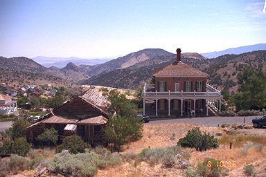
north from C Street downtown. [67] The building on the right in this photo
is the Mackay Mansion. The Mackay family was one of the wealthiest and
most prosperous prospecting families. The Mackays mined over $100,000,000
in silver, an incredible sum of money for a single household in the late
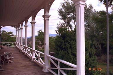
nineteenth century. [77] A nice photo of the porch above the garden on
the east side of the Mackay mansion.
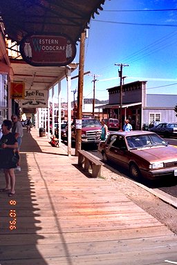
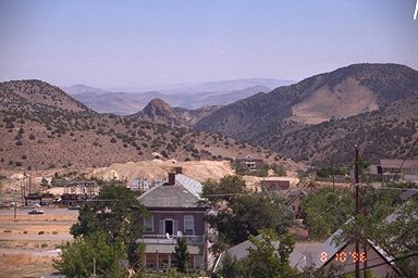
[68] A view of the downtown Virginia City area,
looking west on Nevada State Route 341 (C Street). [69] After walking around
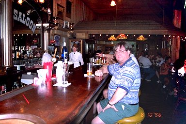
the downtown for a while, we had lunch in one of the historic saloons.
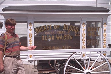
[70] After lunch, John found a new set of wheels near the Bucket of
Blood Saloon.
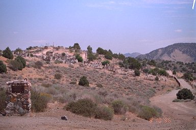
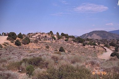
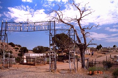
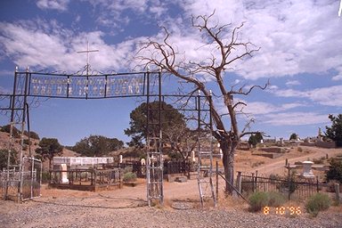
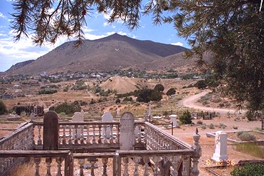
[72, 73, 74, 75 & 76] After lunch, we walked
to the Virginia City cemetary. Located southwest of the city center, it
is divided into several sections based upon a person's religion and nationality/culture.
The gateway in the third and fourth photo here is the entrance to the Catholic
section of the graveyeard.
![[Send Me Mail]](mailbox.gif)